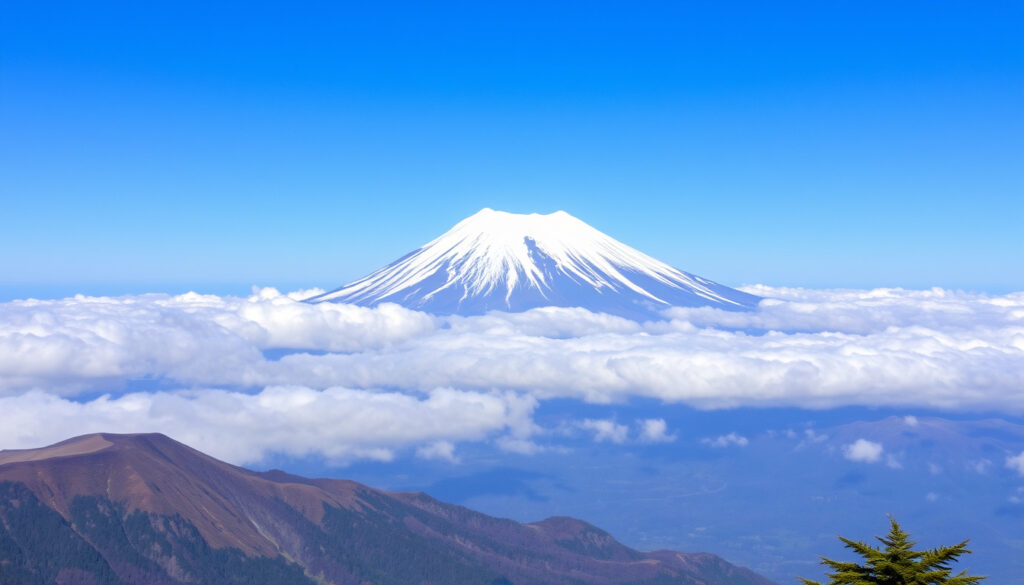
Mt Fuji – Complete Guide to Climbing, Visibility and Travel
Mount Fuji, standing at 3,776 meters (12,389 feet), is Japan’s tallest and most iconic peak. For travelers, it represents three distinct experiences: viewing the mountain from afar, climbing its slopes, and using Tokyo as a base for exploration.
Located on the border of Yamanashi and Shizuoka prefectures, this active stratovolcano last erupted in 1707. Detailed guides, such as the one provided by Japan-Guide, emphasize that it is still considered active, not extinct.
Whether your goal is a day trip for photos, an overnight stay near the Fuji Five Lakes, or a summer ascent to the summit, understanding the timing, access routes, and safety requirements is essential for a successful visit.
How to See Mt Fuji from Tokyo: Distance, Routes, and Best Viewing Spots
Key Insights for Mount Fuji Travelers
- Mount Fuji is a UNESCO World Heritage site and a sacred mountain in Japanese culture.
- The official climbing season is limited to July through mid-September; off-season climbing is dangerous.
- Visibility from Tokyo is highest in winter (December to February), with early mornings offering the clearest views year-round.
- Despite being an active volcano, the last major eruption occurred over 300 years ago, and current monitoring shows no imminent threat.
- Nearby cities such as Fujiyoshida and Fujinomiya offer unique access points, local cuisine, and different perspectives of the mountain.
- Getting to the Fuji area from Tokyo typically takes 2 to 3 hours by highway bus or train.
Snapshot Facts About Mount Fuji
| Fact | Detail |
|---|---|
| Elevation | 3,776 m (12,389 ft) – highest peak in Japan |
| First Ascent | 663 CE (by an anonymous monk) |
| Eruption Status | Active; last eruption 1707-1708 (Hōei eruption) |
| UNESCO Designation | World Heritage site since 2013 (cultural) |
| Climbing Season | Official: July 1 – September 10 (Yoshida route varies) |
| Number of Climbing Routes | 4 main trails (Yoshida, Subashiri, Gotemba, Fujinomiya) |
| Distance from Tokyo | About 100 km (62 mi) as the crow flies |
The most consistent visibility pattern from travel sources points to winter as the prime season. The clearest views are usually in the colder months, especially November to February, and often early in the morning before clouds build, according to Klook and other guides. Late May through June is generally the worst period due to the rainy season and cloud cover.
Classic viewing areas include Hakone and Lake Ashi, the Fuji Five Lakes region around Kawaguchiko, and the Chureito Pagoda for the iconic pagoda-plus-Fuji composition. Travelers on the Tokaido Shinkansen between Tokyo and Osaka can sometimes spot the mountain near Shin-Fuji Station on the right-hand side of the train.
Can You Climb Mt Fuji? Complete Guide to Routes, Season, and Difficulty
Routes and Trailheads
The mountain has four main climbing routes: Yoshida, Subashiri, Gotemba, and Fujinomiya. The Yoshida trail is the most popular and starts at the Yoshida 5th Station, which sits at an elevation of around 2,305 meters. Detailed route information is available from sources like Rakuten Travel.
Typical ascent times from the 5th Station range from 5 to 7 hours, with descent times between 3 and 5 hours. A full round trip generally takes 8 to 12 hours, though some sources report a broader range of 5 to 10 hours for the ascent and 3 to 6 hours for the descent, depending on the specific route and individual pace.
Climbing Season and Duration
The official climbing season generally runs from early July to early September, with some variations by trail. The Yoshida trail season typically aligns with July 1 to mid-September. During this period, mountain huts and facilities are open and weather conditions are most favorable. The official season is set by prefectural authorities and published on the Official Mt Fuji Climbing Website.
Safety, Fees, and Preparation
Mount Fuji is a strenuous climb, and altitude sickness is a genuine risk. Proper gear, warm clothing, and adequate water are essential. While generally safe with proper planning, climbers should be fully aware of the physical demands. A conservation fee of ¥2,000 per person was introduced in 2024 for trailhead access. Climbers do not strictly need a guide, but guided tours are available for those seeking added safety and logistical support.
Climbing Mount Fuji outside the official season (July to mid-September) is dangerous and not recommended. Trail facilities are closed, weather conditions can be extreme, and rescue services are severely limited. The mountain is an active volcano, which adds geological risk to the environmental hazards.
Is Mt Fuji an Active Volcano? Past Eruptions and Current Status
Current Volcanic Status and Monitoring
Mount Fuji is classified as an active stratovolcano, not an extinct one. The Japan Meteorological Agency (JMA) maintains continuous 24/7 monitoring of the mountain using seismic stations and gas measurements. Data from the JMA volcanic activity reports indicates a low probability of eruption in the near term, though volcanic systems can change unpredictably.
The Japan Meteorological Agency operates a comprehensive monitoring network on Mount Fuji, including seismic stations, GPS deformation sensors, and gas measurement equipment. This data provides early warning capabilities and informs the current understanding that no immediate eruption is expected.
The 1707 Hōei Eruption
The most recent major eruption of Mount Fuji occurred in 1707, an event known as the Hōei eruption. This eruption was contiguous with a massive earthquake and resulted in ashfall reaching Tokyo. It remains the last confirmed eruption of the volcano.
The Geological Formation of Mount Fuji
Mount Fuji’s current height of 3,776 meters is the result of a long volcanic history. The original Komitake volcano began forming about 100,000 years ago. The current cone, which created the iconic symmetrical shape, has been building over the last 10,000 years through repeated volcanic activity.
Where Is Mt Fuji Located? Map, Nearby Cities, and Elevation
Mount Fuji lies on the border of Yamanashi and Shizuoka prefectures on the island of Honshu. It is visible from Tokyo and Yokohama on clear days, approximately 100 kilometers southwest of the capital, as noted by Matador Network.
The primary base towns for accessing the mountain are Fujiyoshida (on the Yamanashi side) and Fujinomiya (on the Shizuoka side). Gotemba is another access point, particularly for those using the Gotemba climbing route. These cities offer distinct viewpoints, dining options, and accommodations. The mountain is part of the Fuji-Hakone-Izu National Park, designated in 1936.
What to Eat Near Mt Fuji? Best Restaurants and Local Specialties
Dining options around Mount Fuji are concentrated in the base cities of Fujiyoshida and Fujinomiya. These towns offer a range of restaurants serving local and Japanese cuisine. Many travelers choose to eat in Kawaguchiko or Hakone, which have a wider variety of dining establishments due to their popularity as scenic viewing bases.
Mountain huts along the climbing routes provide simple meals and snacks during the official climbing season, though availability is strictly seasonal.
If you are visiting Mount Fuji on a day trip, consider having a meal at one of the base towns rather than relying on mountain huts, which are only open during the climbing season and offer limited menus. Kawaguchiko and Hakone have the most diverse dining options for travelers based in Tokyo.
What Are the Key Historical Events of Mount Fuji?
- ~100,000 years ago: Volcanic activity begins, forming the Komitake volcano.
- ~10,000 years ago: Mount Fuji’s current cone begins forming.
- 663 CE: First recorded ascent by an unknown monk.
- 1707-1708: The Hōei eruption, the most recent major eruption, contiguous with a massive earthquake.
- 1872: Climbing by women officially permitted (previously forbidden).
- 1936: Part of Fuji-Hakone-Izu National Park.
- 2013: Recognized as a UNESCO World Heritage site (cultural). See the official UNESCO listing.
- 2020-2025: Increased monitoring for volcanic activity; no significant changes reported.
What Do We Know for Certain About Mount Fuji, and What Is Still Uncertain?
Established Information
- Mount Fuji is an active volcano with a low probability of eruption in the near term, based on JMA monitoring data.
- The mountain is visible from Tokyo on clear winter days, especially early in the morning.
- Climbing is a strenuous activity that requires physical preparation and proper gear.
- Multiple dining options exist in the base cities of Fujiyoshida and Fujinomiya.
Information That Remains Unclear
- Long-term volcanic forecasting remains probabilistic; systems can change rapidly.
- Visibility depends on daily weather conditions, which can shift unexpectedly even in favorable seasons.
- Individual fitness levels and susceptibility to altitude sickness cannot be universally predicted.
- The availability of specific restaurants and mountain huts varies seasonally and is subject to change.
What Makes Mount Fuji a Unique Natural and Cultural Landmark?
Mount Fuji holds a dual role as both a natural wonder and a cultural icon in Japan. It is a sacred mountain in Shinto and Buddhist traditions and has been immortalized in countless works of art, including the famous ukiyo-e prints. For a comparably deep dive into how geography and legend intertwine, read about King Arthur – Legend, History, and the Search for Truth.
Geologically, it is one of the most closely monitored volcanoes in the world. The JMA’s surveillance systems provide critical data that helps scientists understand volcanic behavior. The mountain’s formation over millennia tells a story of powerful geological forces that continue to shape the region.
In recent years, increased tourist numbers have led to new management strategies, including reservation systems for climbing and shuttle bus changes. Environmental concerns such as trail erosion and trash management are ongoing challenges, and climate change is affecting the mountain’s snow cover patterns.
Which Official Resources Should You Consult for Mount Fuji Information?
“Mount Fuji is an active volcano… travelers should treat eruption status and weather conditions separately: the mountain can be safe to visit while still remaining geologically active.”
— Multiple travel and geological sources, including Japan-Guide and GetYourGuide
“The clearest views are usually in the colder months, especially November to February, and often early in the morning before clouds build.”
— Klook, Veltra, Japan-Guide
“Low probability in the near term based on current seismic and deformation data.”
— Japan Meteorological Agency
For travelers seeking authoritative information, several official sources provide reliable data:
- The Japan Meteorological Agency offers real-time volcanic activity reports.
- The UNESCO World Heritage Centre details the mountain’s cultural significance.
- The Official Mt Fuji Climbing Website provides up-to-date climbing rules and trail conditions.
- The Japan National Tourism Organization (JNTO) offers general travel guidance.
- The Smithsonian Institution’s Global Volcanism Program maintains a global database of volcanic activity.
What Is the Best Way to Plan a Visit to Mount Fuji?
The best way to experience Mount Fuji depends on your goals. For photographers and casual sightseers, a winter visit offers the clearest views from locations like Kawaguchiko, Hakone, or Chureito Pagoda. For adventurers, a summer climb provides an unforgettable physical challenge. Whichever path you choose, planning around visibility conditions, access logistics, and seasonal limitations is the key to a successful trip. For more in-depth mountain travel guides, see our article on Slieve Donard – Ultimate Guide to Mountain and Hotel.
Frequently Asked Questions About Mount Fuji
Is Mt Fuji a UNESCO World Heritage site?
Yes, it was inscribed as a cultural site in 2013.
What is the best month to climb Mt Fuji?
July and August have the most favorable weather and open mountain huts.
Can you see Mt Fuji from Tokyo every day?
No, visibility depends on weather and season; winter mornings are best.
How dangerous is Mt Fuji?
Climbing is physically demanding but generally safe with proper gear and planning; volcanic eruption is a low-probability risk.
What is the elevation of Mt Fuji in feet?
12,389 feet.
What cities are near Mt Fuji?
Fujiyoshida, Fujinomiya, and Gotemba are the main base towns.
Are there restaurants on Mt Fuji itself?
Mountain huts serve simple meals and snacks during the official climbing season.
How long does it take to climb Mt Fuji?
A typical ascent takes 5 to 7 hours from the 5th Station, with a round trip averaging 8 to 12 hours.
Does Mt Fuji require a climbing fee?
A conservation fee of ¥2,000 per person has been introduced for trailhead access as of 2024.
More related posts
 Amy Poehler – Full Biography, Career, and Personal Life
 Emily Atack – Biography, Age, Career and Family Life
 Wrap of the Day McDonalds – Full UK Weekly Schedule
 Who Is the Next James Bond – Latest Rumors, Candidates, Timeline
 Teresa Giudice – Bio, Net Worth, Husband and Daughters in 2025
 Www BBC Strictly Voting Online Tonight – How to Cast Your Vote
 Narendra Modi – Biography, Age, Net Worth and Facts 2025
 Olympique de Marseille Standings – Ligue 1 2024-25 Final Table